map-derived reference
Pentacity Road Distances
Summary
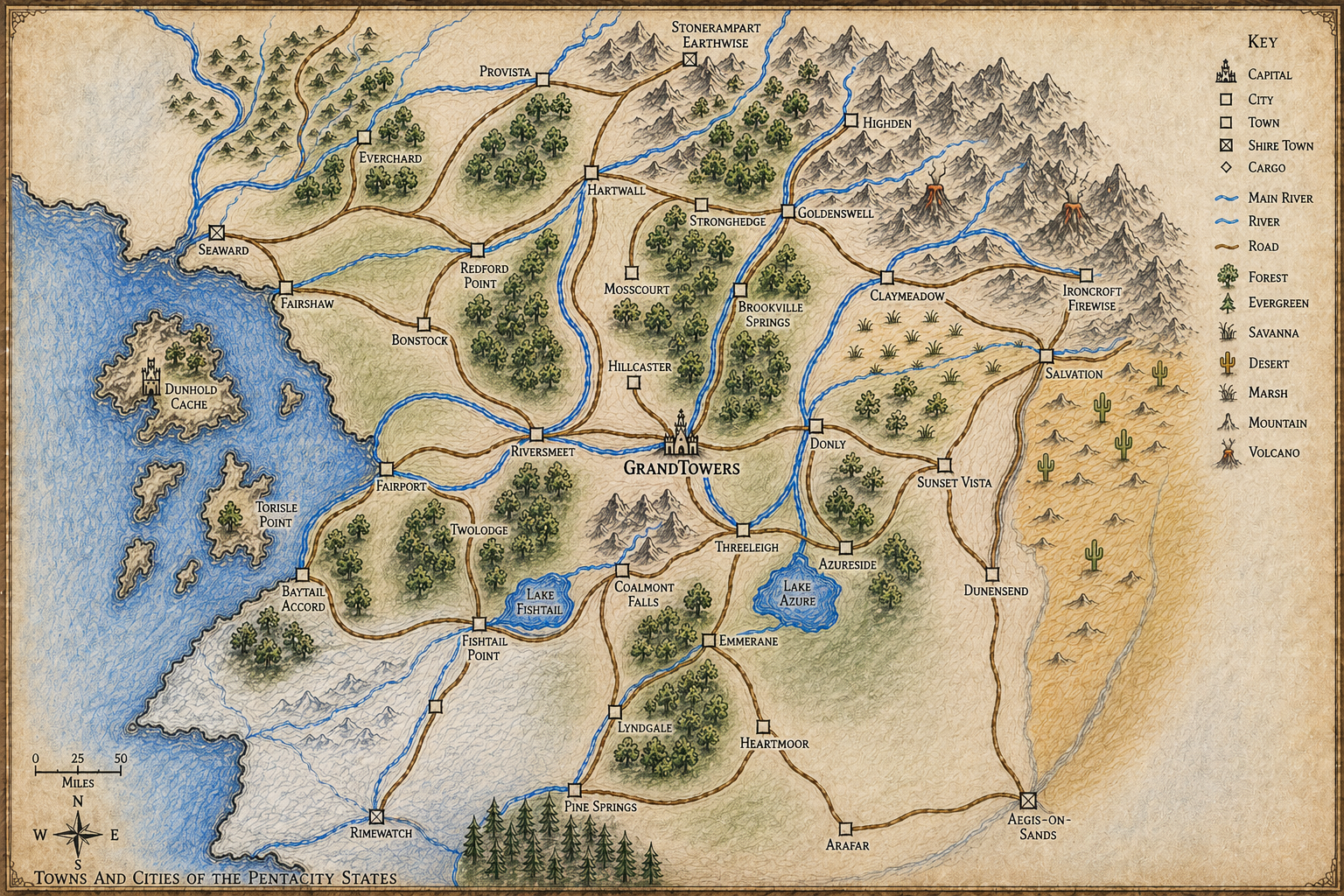
The Pentacity road distances are approximate road-mileage estimates derived from the scale bar on the Pentacity States Map. They should be used for travel planning, route consistency checks, and rough distance comparisons unless contradicted by explicit session notes or cleaned-day records.
Method
- The map’s lower-left scale bar marks 50 miles.
- Visible road centerlines were traced between adjacent labeled road-connected places.
- Distances are rounded to the nearest 5 miles.
- Islands and places without visible road connections on the map are not assigned road distances here.
Adjacent Road Legs
Use Notes
- Longer road journeys can be estimated by summing adjacent legs.
- Prefer explicit source-note mileage when a cleaned day or transcript gives a specific distance.
- The map-derived table is especially useful for spotting travel-time inconsistencies, but it should not override known magical travel, teleport scatter, detours, terrain delays, political borders, or encounter-driven pacing.